CatchAtlasUK fish logo

CatchAtlasUK

UK fishing atlas for coast, estuaries, rivers and inland waters
Members
Live atlas
Tools
Start here

What do you want to do?

Go straight to the job you came here for. You can always use the five buttons at the bottom of the screen to move around.

🎯 Where should I fish?Rank nearby options for today or another date ⌖ Open fishing atlasSearch and filter where to fish ⚡ What looks good now?See current fishing signals 🧭 Plan a tripMonth, region and approach 🎣 Carp CentreFind waters and plan sessions 🐟 Species guidesFind the fish you want ⭐ MembershipPlans, login and Premium
CatchAtlasUK logo
UK fishing decisions made simpler

Tell us where you want to fish. We’ll help with what, when and how.

CatchAtlasUK brings together UK species seasons, regional presence, weather, daylight, tides and established fishing methods so you can quickly see what is worth targeting, when conditions may be more favourable, and how to approach the session.

Monthly targetsSee which species are in season and worth targeting this month.
Regional guidanceNarrow your choices by UK region and water type, from the coast and estuaries to rivers and inland waters.
Your own logSave catches, notes, and reports for future trips.

Built for anglers planning real trips

CatchAtlasUK brings together seasonal species presence, regional guidance and your fishing records so you can quickly decide what is worth targeting and where to concentrate your effort. Explore coast, estuaries, rivers and inland waters, compare likely species by month and region, then turn the shortlist into a practical session plan.

Whether you are planning ahead or deciding if it is worth heading out today, CatchAtlasUK helps you target the right fish at the right time.

CatchAtlasUK recommendation engine

Where should I fish?

Tell CatchAtlasUK where you are, how far you will travel and what sort of fishing you want. We will rank useful starting points using the Atlas, seasonal species information, published river access and — for Premium members — live local conditions. Carp members can also use the protected carp-water evidence database.

One searchplace • species • access • conditions
Choose your preferences and CatchAtlasUK will build a shortlist.
A quicker route to a better plan

From “where shall I go?” to a practical fishing plan

CatchAtlasUK is designed around the decisions anglers make before a trip, not around a long list of disconnected features.

Try the free atlas
1Choose where & when

Search a UK place, pick a month or date, and narrow the type of water you want to fish.
2See what looks worthwhile

Compare likely species and seasonal presence, then use weather, daylight, tides and local conditions to refine the opportunity.

3Turn it into a session

Check methods, bait, rigs and tackle, then save targets or build a trip plan.

🇬🇧 UK-focused planning🔒 Secure Stripe billing↻ Manage or cancel online🎣 Free tools before you subscribe
Complete Premium carp toolkit

Find the water. Plan the session. Choose the rig, bait and tackle.

The CatchAtlasUK Carp Centre combines the 5,402-record packaged water database with a Session Planner, tactics matcher, 12-rig library, bait guide, equipment finder, British record information, Carp Academy and your own personal catch log.

5,402 packaged water recordsSearch the static database with clear evidence levels and stored map points.
Evidence shownSee whether a record is independently checked, backed by carp evidence, or a mapped candidate still being verified.
Plan the whole sessionConditions, tactics, rigs, bait, tackle and your personal catch history work together.
See exactly what Premium unlocks

More than a locked button — preview the tools before you subscribe

CatchAtlasUK Premium is designed to help turn a general idea into a practical fishing plan. These previews show the kind of information and controls available inside each Premium tool, so you can decide whether they are useful for the way you fish.

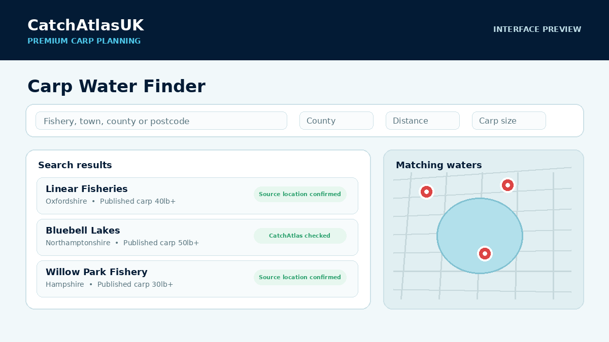
Preview of the CatchAtlasUK Carp Water Finder showing venue results and mapped waters
Carp planning

Carp Centre & Session Planner

Search the independent water database, build a conditions-led session plan, choose tactics/rigs/bait, shop the setup and log the result.

  • Search by fishery, town, county or postcode
  • See location-confidence information
  • Run conditions-led session windows on checked fisheries
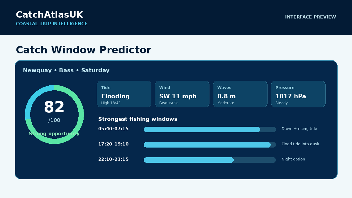
Preview of the CatchAtlasUK Catch Window Predictor with opportunity score and ranked fishing times
Coastal planning

Catch Window Predictor

Turn a coastal place, date and target into ranked fishing windows using the conditions that matter to the session.

  • Tide movement, daylight, wind and waves
  • Pressure, rain and seasonal species profile
  • Ranked times and suggested approach
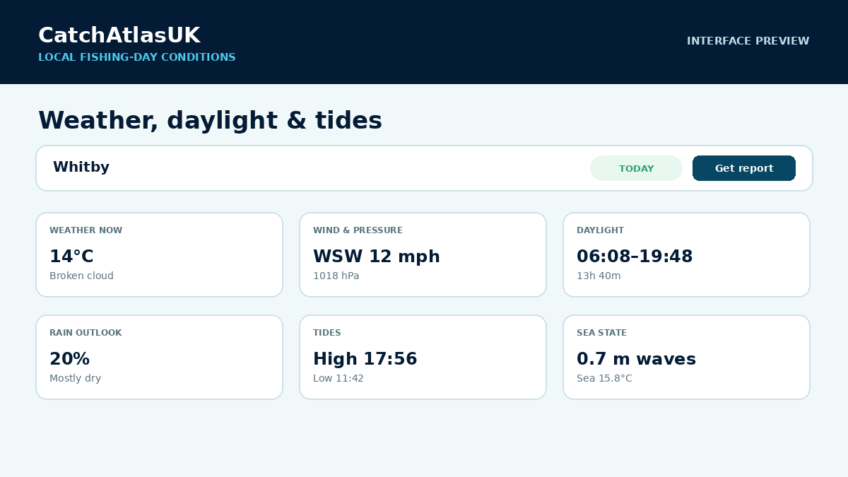
Preview of CatchAtlasUK local fishing conditions showing weather, wind, pressure, daylight, tides and sea state
Local conditions

Weather, daylight, tides & sea state

Enter a UK place or postcode and bring the main fishing-day conditions together instead of checking several separate services.

  • Weather, wind and pressure
  • Daylight and rain outlook
  • Tides and marine conditions where relevant
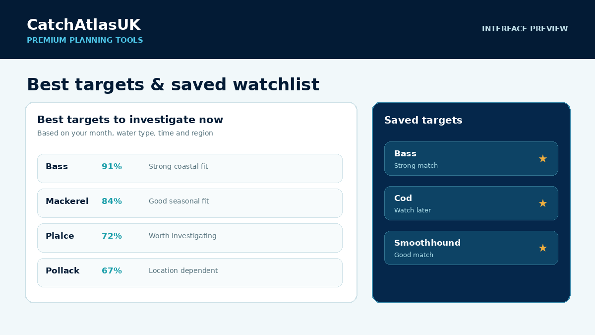
Preview of CatchAtlasUK best targets and saved target watchlist
Decision support

Best targets & saved watchlist

Shortlist species worth investigating for the plan you are building and keep useful targets ready for a future trip.

  • Prioritise likely targets
  • Save species you want to revisit
  • Use match indicators to focus your planning
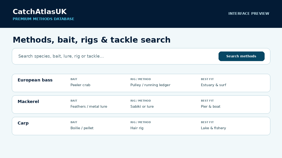
Preview of CatchAtlasUK methods database showing species, bait, rigs and approaches
Methods

Bait, rigs, lures & tackle search

Move from choosing a target to thinking about how to fish for it, with a searchable methods database alongside the planner.

  • Search species, bait, rig or lure
  • Compare practical approaches quickly
  • Jump into relevant tackle suggestions
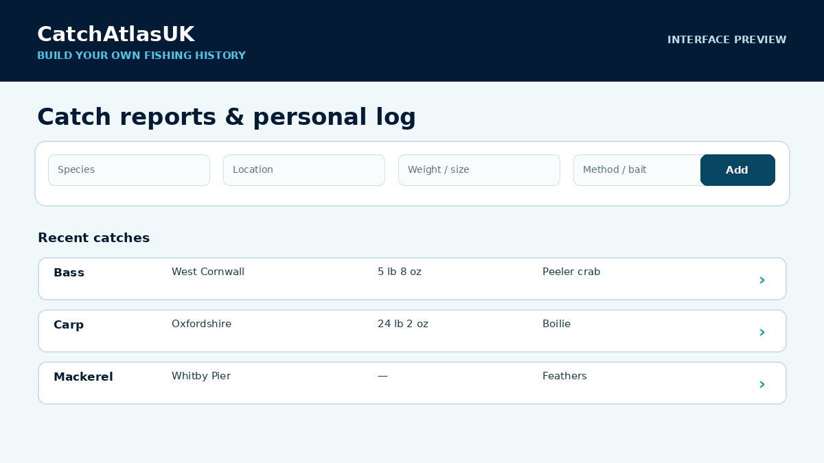
Preview of CatchAtlasUK catch reports and personal fishing log
Your fishing history

Catch reports & personal log

Keep a useful record of what you caught, where and how, so previous sessions can inform future decisions.

  • Record species, location, size and method
  • Build a simple personal fishing history
  • Refer back to successful approaches
Want to try the full toolkit for one trip? The 24-hour Premium Pass is a one-off £2.49 payment and does not renew automatically.See Premium options
Explore the essentials free. Go Premium when you want the full planning advantage.

See the value before you pay

Browse the atlas, species calendar and quick planning information first. Upgrade when you want CatchAtlasUK to bring the deeper planning signals together for a specific trip.

Free explorer
  • 5 free UK atlas location searches on this device
  • Species calendar & seasonal guidance
  • Quick catch signals & trip starting points
Explore free
Premium planning
  • Complete Carp Centre: finder, planner, rigs, bait, equipment & My Carp
  • Best-window & saved-target tools
  • Weather, daylight, tides & sea state
  • Catch Window Predictor, methods, reports & personal log
See Premium plans
Membership

Plan more confidently with CatchAtlasUK Premium

Know when to go, what to target and how to approach the session. Premium brings the strongest planning tools together in one place, with your account and billing under your control.

Checking account status…
  • Complete Premium Carp Centre with 5,402 packaged water records and visible evidence levels
  • Use the Carp Session Predictor
  • Know when conditions look best
  • Save targets for future trips
  • Choose bait, rigs & methods
  • Record catches and spot useful patterns
  • Keep your personal catch log
  • Manage or cancel online
Accounts & billing
ONE-OFF
24-hour Premium Pass
£2.49for 24 hours
Full Premium for one fishing trip. One-off payment, starts when Stripe confirms payment, no automatic renewal.
Monthly membership
£3.99per month
Flexible access. Manage or cancel renewal online.
BEST VALUE
Yearly membership
£29.99per year
About £2.50 a month. Save £17.89 a year (37%) compared with paying monthly.
Status: Checking account and membership status…
Secure checkout by StripeManage payment details onlineCancel renewal from Members
Before you subscribe

Straight answers

Does the 24-hour pass renew?

No. It is a one-off £2.49 payment. Premium begins when Stripe confirms payment and expires 24 hours later. Monthly and yearly plans are separate recurring subscriptions.

Can I cancel a subscription?

Yes. Signed-in monthly or yearly members can open the secure Stripe billing portal from the Members menu and manage or cancel renewal.

Do I need Premium to try the site?

No. You can use 5 free Atlas location searches on this device, browse the species calendar and use selected free planning tools before upgrading.

How reliable are the CatchAtlasUK predictions?

CatchAtlasUK helps you make a better-informed fishing plan. It combines seasonal species patterns with tides, weather, daylight, location and species behaviour to highlight periods that may offer stronger conditions. Fishing can never be guaranteed, and local conditions can change, but the tools give you useful evidence to compare before you travel.

Already used CatchAtlasUK for a real trip?Tell us what helped, what didn’t, or what you caught. Genuine angler feedback will shape the next improvements.
Send feedback
Preview of Premium catch intelligence

Premium catch intelligence

Turn the current month, region and water type into a quicker shortlist of species worth investigating before you build the full session.

  • Seasonal catch signals
  • Species to watch
  • Quick-start target planner
24 hours £2.49 • Monthly £3.99 • Yearly £29.99
Weekly fishing signals

What looks strongest now

Start with the strongest seasonal signals, strengthened by your own recent catch reports when available, then jump into the atlas to refine by region and method.

How to: Use the weekly signal as a quick starting point, then refine the shortlist by region, water type and method.
Momentum this week

Species to watch

A quick view of species showing the strongest seasonal momentum, with your saved catch reports adding extra context when available.

How to: Check the strongest current signals before choosing what to target.
Quick start

Plan your next trip

Set a month, region, and water type here, then send those choices straight into the trip planner below.

How to: Set your month, region, and water type here, then send those choices straight into the full trip planner.
Open trip planner

CatchAtlasUK controls

CatchAtlasUK
Search, filter species by season, and refine what anglers can catch by water type, time and conditions.
Start by choosing a month or searching a location, then explore likely targets and best methods.
How to: Search by place, then use the filters to narrow species by season, water type, time, and conditions.
Explore the atlas faster
Water: Sea
Water: Inland
Category: Fish
Category: Shellfish
MONTHS
TIME OF DAY
PREFERRED CONDITIONS
Map & heat —
Species calendar
Preview of Premium planning tools

Premium planning tools

See which targets look worth investigating, save species you want to revisit and check local fishing-day conditions in one planning area.

  • Best-target shortlist for the plan you are building
  • Saved target watchlist
  • Local weather, daylight, tides and sea state
24 hours £2.49 • Monthly £3.99 • Yearly £29.99

Best targets to investigate now

Get a fast shortlist based on month, time of day, water type and region so you know which species are worth investigating first before you build the full trip plan.

Saved targets worth watching

Anglers can save species they want to target later. Each card also shows a match indicator based on the information available, helping you prioritise the targets that fit your current plan.

Open trip planner
Local conditions

Weather, daylight & tides

Enter a UK place or postcode for a fishing-day conditions report. Use the arrows to move a day at a time. Inland or non-tidal locations show tides as N/A.

TODAY
Search a place to see local conditions for the selected date.
Preview of Premium Catch Window Predictor

Premium Catch Window Predictor

Choose a coastal location, date and target species, then compare the periods where the available conditions may line up more favourably.

  • 14-day coastal planning horizon
  • Ranked fishing windows and opportunity score
  • Tides, daylight, wind, waves, pressure and seasonal profile
14-day planning • 24 hours £2.49 • Monthly £3.99 • Yearly £29.99
Premium trip intelligence

Catch Window Predictor

Choose a UK coastal location and date. CatchAtlasUK brings together modelled tide movement, daylight, wind, waves, pressure, rain and the seasonal profile of your chosen species to rank the strongest times and approaches for the session.

14-daycoastal outlook
Select a location and date to build your coastal fishing outlook.
What’s biting this month

Make the most of this month’s best opportunities.

CatchAtlasUK uses month-by-month species presence to highlight targets worth considering now, then lets you refine them by region, method and water type.

How to: Start with these seasonal targets, then use CatchAtlasUK controls below to narrow them by region, method, and water type.
Suggestions update automatically using the current month and your selected water type.
Keep exploring

Fishing guides & reference

Useful reference pages stay available without interrupting the main planning journey.

UK fishing calendar, species guide and angling atlas

CatchAtlas UK is a fishing planning guide for anglers across the United Kingdom. It helps you compare fish species, seasonal catch windows, likely fishing methods and regional hotspots before choosing where to fish.

Use the atlas to plan sea fishing, coarse fishing and mixed sessions by month, water type, region and target species. The site is designed to answer practical questions such as what fish are active now, which UK regions are worth checking, and which bait, lure or rig methods may suit the conditions.

Browse UK fishing guides

Search engines and anglers can also browse CatchAtlas UK through static guide pages for fish species, monthly fishing calendars and UK fishing locations.

\n